Contexte
- Mission principale de l’Insee → le recensement de la population :
- Communes ≥ 10 000 hab : 8% /an
- Communes < 10 000 hab : 100% /5 ans
- Information du nombre de logements ?
Répertoire des Immeubles Localisés
- Le RIL :
- Inventaire du bâti
- Communes de +10 000 habitants
- Permis de construire et informations locales
- Bases de sondage des enquêtes de recensement
La qualité du RIL est bonne en France hexagonale ✅… mais loin d’être fiable dans les DROM ⚠️
→ Autre méthode : découpage en îlots
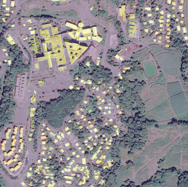
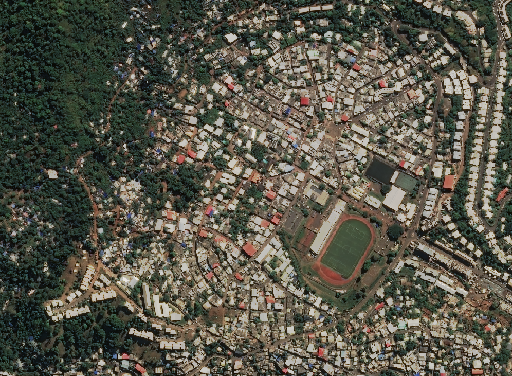
Recensement dans les territoires d’outre mer
Contexte critique : Mayotte et Guyane
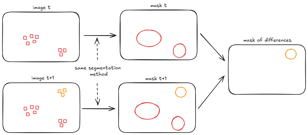
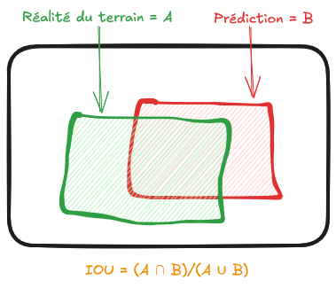
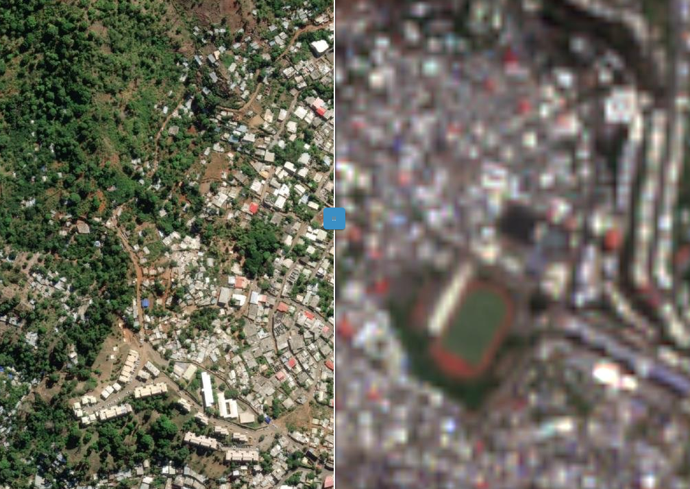
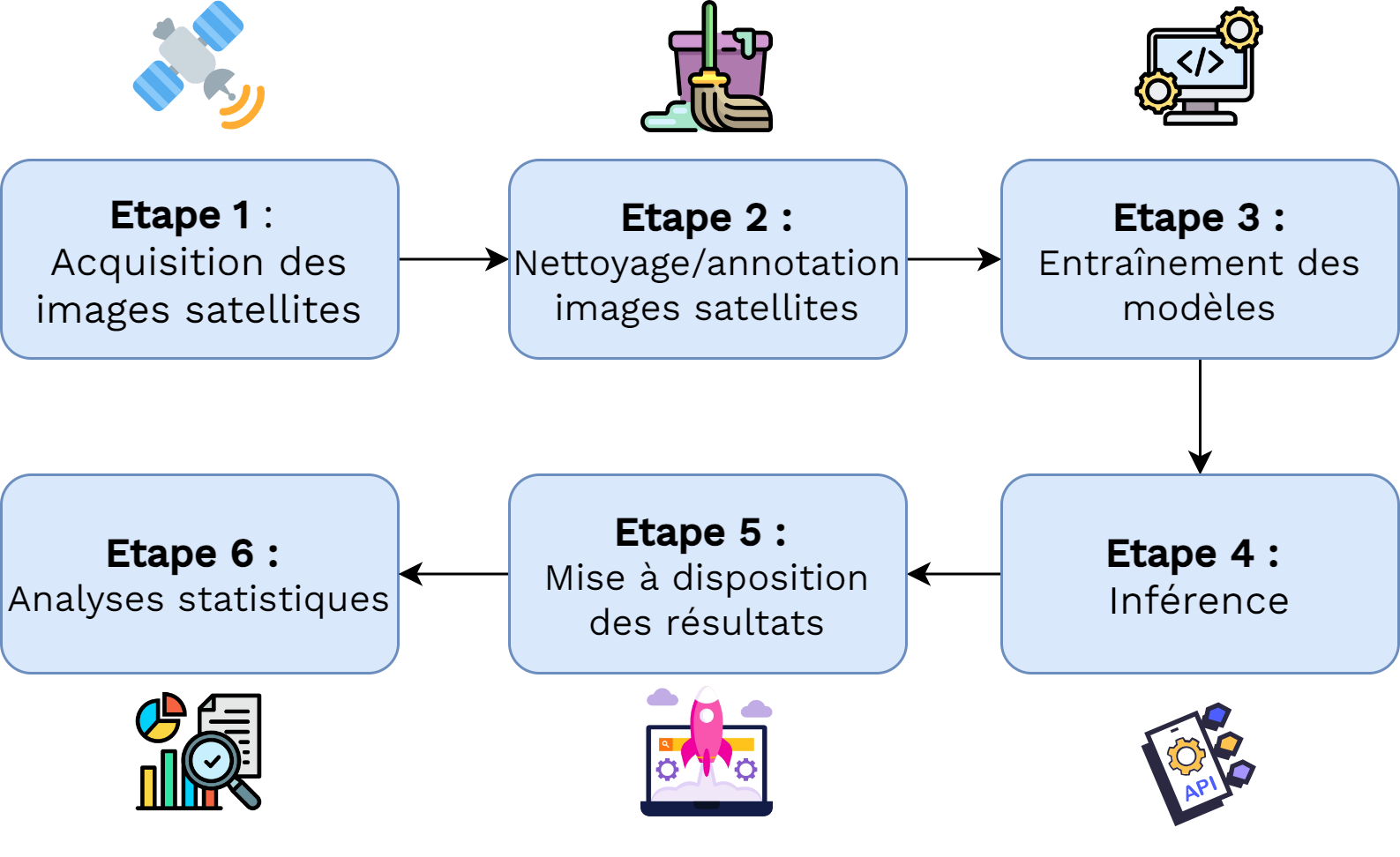
Pour compléter le RIL dans les DROM : enquête cartographique → très lourde
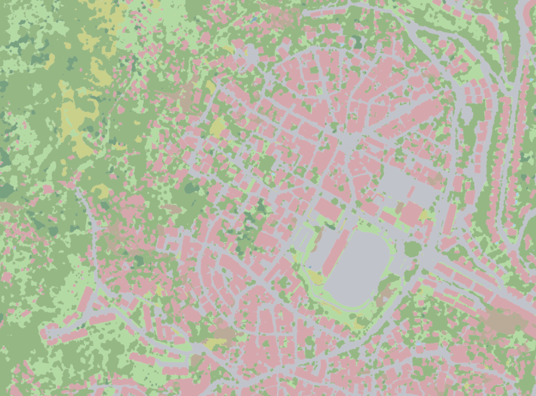
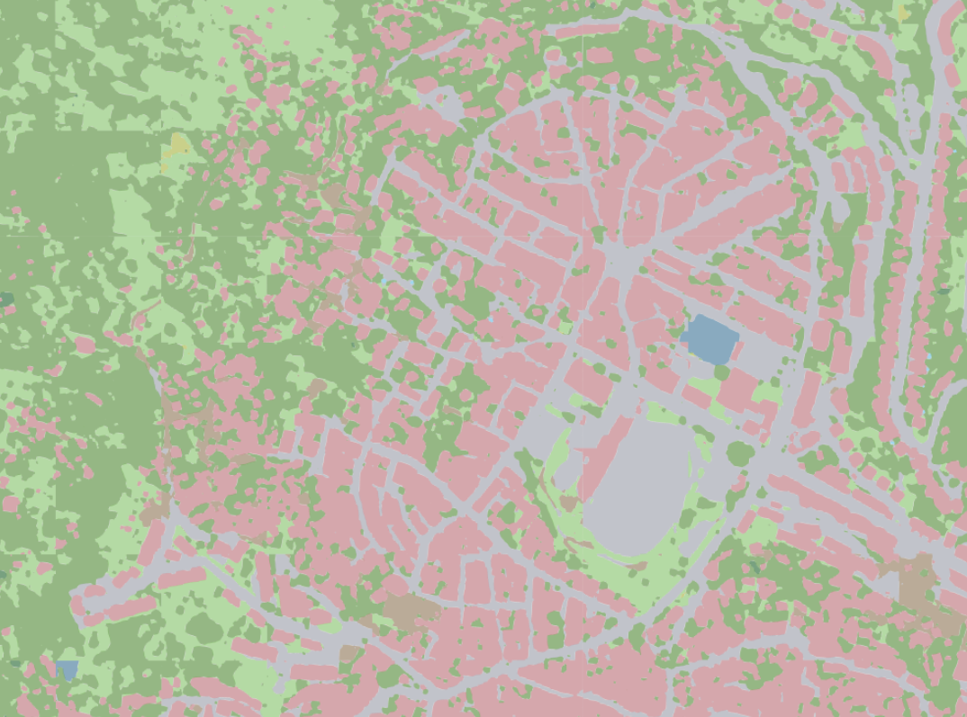
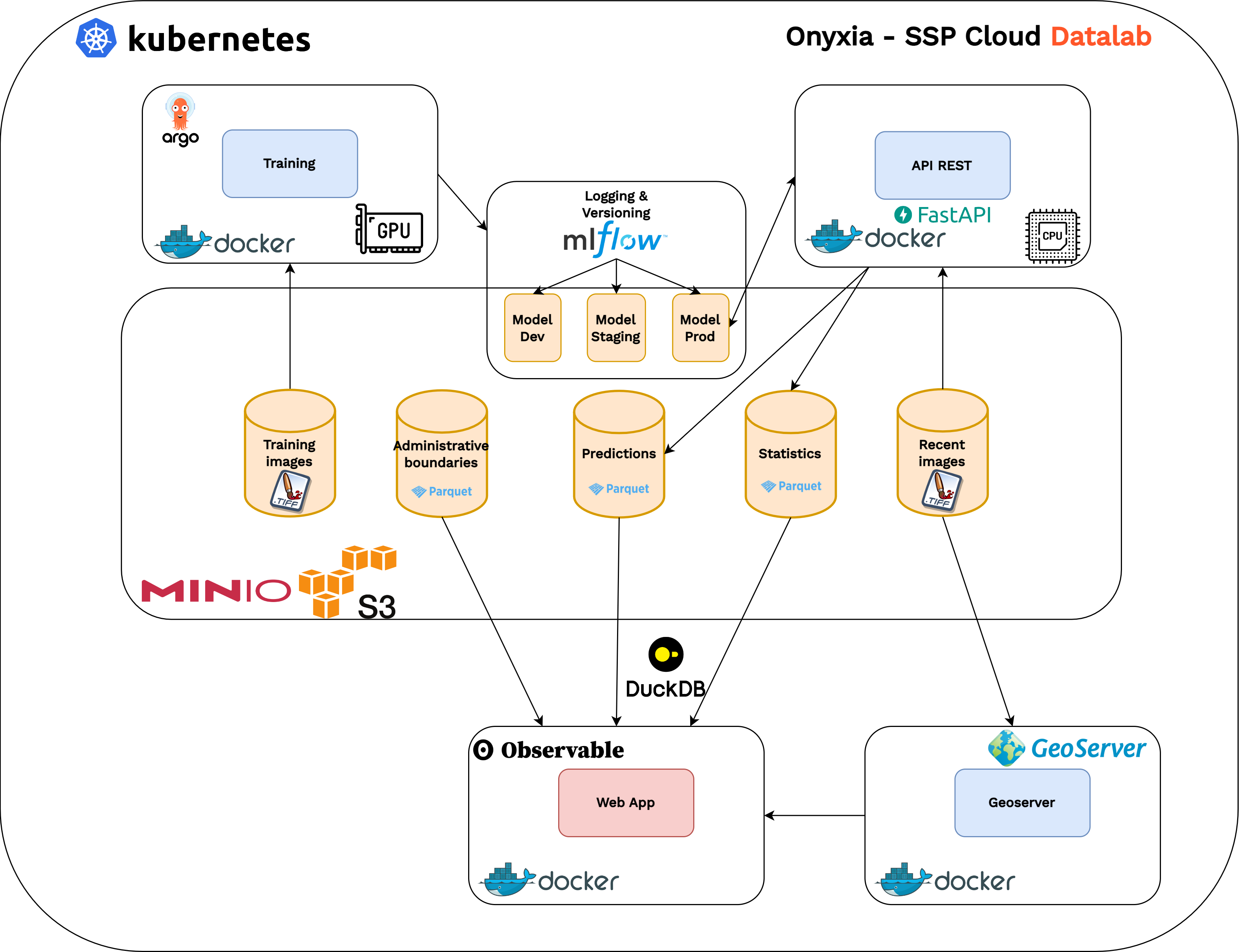
L’imagerie satellitaire pour optimiser le processus du recensement dans les DROM ? 🛰️